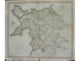
Engraved County Map, later hand-colouring in outline, from New British Atlas,
Engraved County Map, later hand-colouring in outline, from New British Atlas,
| Condition | two vertical folds, stain in bottom right corner, two tears repaired, a little fraying around borders, |
| Publication | Published by John Stockdale, 1805. 17in x 20in (Sheet size) |
- Product Code: RGW13016
- Availability: In Stock
-
£15.00

