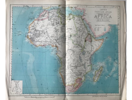
Colour map, from Letts's "Popular Atlas", showing boundaries.
Shows how little of the continent was occupied by European powers at this period.
Colour map, from Letts's "Popular Atlas", showing boundaries.
Shows how little of the continent was occupied by European powers at this period.
| Condition | central fold, small mark, |
| Publication | 1881. 14in x 17.25in (36 x 44cm) |
- Product Code: RGW24914
- Availability: In Stock
-
£20.00

