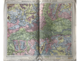
Colour map, with mile circles, from Letts's "Popular Atlas",
This map shows the height of the land in London.
Colour map, with mile circles, from Letts's "Popular Atlas",
This map shows the height of the land in London.
| Condition | central fold, small split at foot of fold, |
| Publication | 1881. 14in x 17.25in (36 x 44cm) |
- Product Code: RGW24888
- Availability: In Stock
-
£20.00

