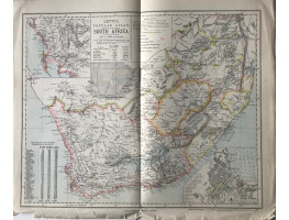
Colour map, from Letts's "Popular Atlas", showing gold and diamond fields, railways, and inset plans of Cape Town and environs of the Cape.
Colour map, from Letts's "Popular Atlas", showing gold and diamond fields, railways, and inset plans of Cape Town and environs of the Cape.
| Condition | central fold, fraying in bottom margin, |
| Publication | 1881. 14in x 17.25in (36 x 44cm) |
- Product Code: RGW24881
- Availability: In Stock
-
£15.00

