Maps

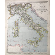
Statistical Map of Italy (53 miles to the inch)
ITALY. LETTS SON & CO LTD.
Colour map, from Letts's "Popular Atlas", showing boundaries, wine growing areas and submarine teleg..
£5.00
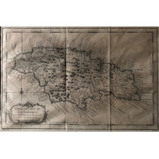
'Carte de L'Isle de La Jamique' Map of Jamaica
JAMAICA. BELLIN, S.
Engraving, with roads, hills, parishes and rivers,..
£35.00
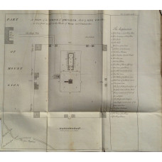
'A Plan of the Temple of Jerusalem, Built by King Solomon as it found recorded in the Books of Kings and Chronicles' by Emanuel Bowen.
JERUSALEM.
Engraving, from 'An universal history, from the earliest account of time', scale and key,..
£40.00
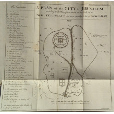
'A Plan of the City of Jerusalem according to the Description thereof in the Books of the Old Testament but more especially in that of Nehemiah' by Emanuel Bowen.
JERUSALEM.
Engraving, from 'An universal history, from the earliest account of time', scale and key,..
£50.00
Road Map The Hashemite Kingdom of Jordan.
JORDAN. ROYAL JORDANIAN GEOGRAPHIC CENTRE.
Folding colour map, scale 1:750,000...
£20.00
Map of Isle of Thanet. Kent.
KENT. ISLE OF THANET. THOMAS MOULE [1784-1851]
Engraved map by Thomas Moule, vignettes of Ramsgate Harbour and North Forland Lighthouse, two coats ..
£15.00
Map. Leicestershire.
LEICESTERSHIRE. J. & C. WALKER. LEWIS.
Map drawn by R. Creighton, engraved by J. & C. Walker, from Lewis's Topographical Dictionary,..
£10.00
Lincolnshire.
LINCOLNSHIRE. A. FULLARTON
Engraved map, showing rivers, roads and hundreds, engraved by Gray & Sons,a little foxing,..
£10.00
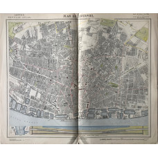
Plan of the City of Liverpool (scale 4.75 inches to the mile)
LIVERPOOL. LETTS SON & CO LTD.
Colour plan, from Letts's "Popular Atlas", showing roads, docks and quays.A pleasing detailed plan...
£30.00
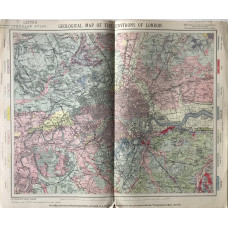
Geological Map of the Environs of London (scale 7.5 inches to 10 miles)
LONDON. LETTS SON & CO LTD.
Colour map, with mile circles, from Letts's "Popular Atlas",..
£20.00
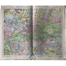
Orographical Map of the Environs of London (scale 3/4 inch to 1 mile)
LONDON. LETTS SON & CO LTD.
Colour map, with mile circles, from Letts's "Popular Atlas",This map shows the height of the land in..
£20.00
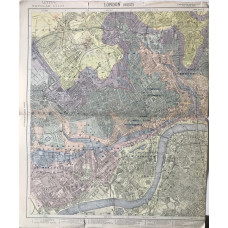
London (West), London (East) (scale 3/4 inch to 1 mile)
LONDON. LETTS SON & CO LTD.
2 colour maps, from Letts's "Popular Atlas", shows streets, railways, wharfs and heights of land...
£50.00
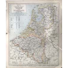
General & Statistical Map of Belgium and the Netherlands. (18 miles to the inch)
LOW COUNTRIES. LETTS SON & CO LTD.
Colour map, from Letts's "Popular Atlas", showing railways, roads, canals, and boundaries...
£5.00
Map of Merionethshire.
MERIONETHSHIRE. EMANUEL BOWEN.
Engraved County Map, above map, decorative cartouche with title "Road from London to Montgomery", on..
£15.00
Map of Merionethshire.
MERIONETHSHIRE. JOHN SELLER. FRANCIS GROSE
Engraved County Map, with text below, from Grose's "The Antiquities of England and Wales"An attract..
£20.00
